| Bankruptcy & Debt Information | Around ARIZONA Home |
 |
|
||||||||||||||||||||||||||||||||||||||||||||||||||||||||||||||||||||
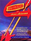
The Atlantic and Pacific Railroad. On July 27, 1866, Congress chartered the Atlantic and Pacific Railroad to build a railway from Springfield, Missouri, across the Indian Territory to the Colorado River, and from there to San Diego. The major asset of the upstart railroad was a federal land grant of a 200 foot right-of-way along the alignment of the future railroad, and twenty odd numbered sections of land per mile on each side of the tracks across New Mexico and Arizona territories. The alignment in those territories roughly followed the 35th parallel which runs between the east and west borders between the top one-third and bottom two-thirds of the territories. This just happens to be very close to the alignment chosen for Route 66 in Arizona when it was created. Future governors invest. The original investors in the A&P included future governors of the Arizona Territory, John C. Fremont (1813-1890) and A.K.P. Safford (1830-1891). Safford, known both as the "little governor" because of his short stature, and "the governor who granted himself a divorce" was appointed governor in 1869 and served until 1877. Fremont had been a U.S. Senator from California, its governor, and a candidate for U.S. President against James Buchanan. Although he was governor from 1878 to 1882, he did not arrive in Arizona until 5 months after the appointment and departed for the East the next year, returning to Arizona only to resign. Bankruptcy! A&P shareholders were not destined to make a fortune on their investment. By 1876 it was bankrupt. It had completed only 351 miles of track in Missouri and the Indian Territory. The St. Louis and San Francisco Railroad, known as the "Frisco", acquired the bankrupt A&P, but it was also perilously close to bankruptcy. It began to look like a railroad might not be making its way across Northern Arizona. Enter the Atchison & Topeka. The company which would actually build under the A&P charter had its origins seven years before that charter was granted. In 1859 the Kansas legislature granted a charter to build a railroad from the bank of the Missouri river in the northeast corner of Kansas through nearby Atchison and terminating in Topeka--a distance of less than 100 miles. The next year Colonel Cyrus K. Holiday, a farmer, land speculator and lawyer, met with a dozen other men in a small brick law office in Atchison, Kansas, and formally organized the Atchison & Topeka Railroad. But it would be nearly a decade before any construction would begin. Holiday's vision was not the making of a railroad linking two cities in northeastern Kansas. He dreamed of a railway stretching from Kansas along the Santa Fe Trail into New Mexico and covering a distance more than ten times that of the original charter. It took four more years to push legislation through Congress which might make this dream possible. On March 3, 1863, President Lincoln signed legislation giving a three million acre land grant for a railroad extending from Atchison across Kansas to its western border "in the direction of Fort Union and Santa Fe." By the end of the year, the upstart company had changed its name to the Atchison, Topeka and Santa Fe Railroad, and was attempting to raise money--to meet a condition of the grant that the line be completed to the Colorado border by December 31, 1872. It was not until October 30, 1868 that it enough funds were available to start construction. In barely more than 4 years and just 3 days before the deadline the railroad reached the Colorado border.
It was a call that the AT&SF could not answer. It's charter extended no further west than Albuquerque. The A&P, then owned by the financially strapped Frisco Railroad, had the charter that the AT&SF needed to reach the Colorado River. In November 1879 the directors of the three railroads reached an understanding known as the Tripartite Agreement. Under that agreement the AT&SF purchased a half interest in A&P and used its charter to extend the line through the rest of New Mexico and Arizona under the A&P name. The pressure to complete the line as soon as possible was enormous. The Southern Pacific, which already had a route crossing southern Arizona through Benson, Tucson and Yuma, and virtually controlled rail traffic to California, did not take kindly to competition. It could be counted on to attempt to cut off the AT&SF from the coastal market. Lewis Kingman surveys the Arizona alignment. Preparation for the Arizona rail route began immediately when the agreement was finalized. In April 1880, railroad engineer Lewis Kingman set out from New Mexico with a survey team of twenty men and five wagons to map the rail route. They quickly plotted the line's path between Rio Puerco in New Mexico to the present site of Holbrook. From there they followed the Little Colorado River to Sunset Crossing near Brigham City. Brigham City was a fort built by the Mormons in 1876 and is now within the Winslow city limits, near I-40 on the same exit (#253) as Wal-Mart #1328. From the Winslow area, Kingman headed to the western end of the line, skipping the middle part of the alignment across Arizona's high country until the summer of 1881. By mid-summer, Kingman and his crew, including W. A. Drake, H.R. Holbrook, and J.E. Early, had completed the initial survey. With the survey completed, Kingman moved on to heading up the construction crews.
Construction begins. Construction was begun near Albuquerque in the summer of 1880 when Kingman had barely started his survey. That summer, the first rail was put down in Arizona in a two and a half mile segment in the Querino Canyon just west of present day Houck. The canyon was only wide enough for a single rail line, and the A&P needed to preempt an expected attempt by the Southern Pacific to block the A&P's access by building first. Even before construction was begun the A&P began to let tie cutting and road grading contracts. The company followed the practice of contracting with local construction firms to clear and grade portions of the line, do some bridge and tunnel work, and provide materials. By the time summer came in 1881, more than two thousand men were working in Northern Arizona preparing the way for the rails. Those numbers included groups of Mormons put together by John W. Young, son of Brigham Young, as well as crews of Price, King and Company and Colonel J.T. Simms who was to do bridge and tunnel work in Johnson's Canyon. The A&P employed almost anyone they could find to work. Although they preferred to hire local labor, rural Arizona had a very limited labor pool. They recruited local Hispanics, Apaches and Navajos. Unlike the Southern Pacific which hired Chinese gangs out of Southern California, the A&P recruited recent emigrants from the mid-west resulting in crews with a large Irish contingent. Delays. The first major delay in construction occurred at Canyon Diablo. Engineers had recognized the problem in breaching the 550 foot wide, 225 foot deep limestone canyon, so construction on a bridge was begun well before the rails reached the east side of the canyon. Work was begun on masonry pedestals and abutments for the eleven span prefabricated steel bridge. Bridge components began to arrive by rail to the end of the line in the fall of 1881, and were were hauled by mule team to the construction site. The bridge would have been completed much earlier, but the $250,000 bridge turned out to be a few feet short on each end. Workers had to wait for several months for replacement spans to be completed and shipped. Finally, on July 1, 1882, the first train made its way across the structure. Johnson's Canyon between Williams and Ash Fork was another problem. A short but difficult tunnel, and two bridges were required. An unexpected segment of Malpais rock and a labor shortage slowed completion of the 366 foot tunnel. It was not until October 1882 that the canyon work was completed and track could be laid into Ash Fork. Route completed. Work began on a 1700 foot wood trestle bridge across the Colorado River from Needles, CA in April 1883. Originally intended to be a temporary bridge, the company decided to make a permanent structure resulting in a six week delay. Then the Colorado flooded, wiping out much of the nearly complete bridge. Workers had to wait about a month before the water had receded enough to resume work. Upon completion of the bridge, rails were brought into Needles on August 3,1883, completing the A&P charter. The Atchison, Topeka and Santa Fe today. In the early 1990's, the Santa Fe embarked on a program to streamline operations. Operating regions were combined. Headquarter were moved from the Railway Exchange Building in downtown Chicago to smaller, more modern and less expensive offices in Schaumburg. Maintenance was consolidated in a central location in Topeka. The work force was reduced by 20%. At the same time they ordered 123 new locomotives, the biggest such order in the company's history. Santa Fe shed less profitable businesses and sold off rail routes, reducing the system's size from around 11,000 miles of rail in 1980 to 8,000 miles in 1992. At the same time, it emphasized more profitable areas like intermodal traffic--providing rail transport for highway semi-trailers--and catering to large users like the United Parcel Service.
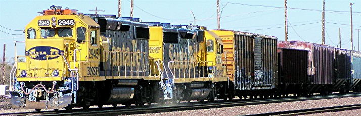
The new company's logo looks a lot more like Santa Fe's logo than the BN logo, confirming the observation that Santa Fe with its renowned management team would be the dominant partner in the new organization. The BN logo was a large "B" with a smaller "N" inscribed within it. The new logo keeps the Santa Fe cross within a circle, but now has Burlington Northern name added to the circle.
|
|
|||||||||||||||||||||||||||||||||||||||||||||||||||||||||||||||||||
|
||||||||||||||||||||||||||||||||||||||||||||||||||||||||||||||||||||
 The
Atchison, Topeka & Santa Fe pushes westward. On February 29,
1876 the AT&SF reached Pueblo, Colorado. By December 7, 1878,
the first AT&SF train had pulled across the New Mexico border.
On February 16, 1880 tracks were completed bringing the line to Santa Fe.
The AT&SF had fulfilled Holliday's vision, but the west coast was
calling.
The
Atchison, Topeka & Santa Fe pushes westward. On February 29,
1876 the AT&SF reached Pueblo, Colorado. By December 7, 1878,
the first AT&SF train had pulled across the New Mexico border.
On February 16, 1880 tracks were completed bringing the line to Santa Fe.
The AT&SF had fulfilled Holliday's vision, but the west coast was
calling.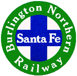 In
1993 Santa Fe had total revenues of $2.4 billion and net income of $338.8
million. Its management team was being viewed as the best in the
industry. In contrast, the much larger Burlington Northern had lower
profit than Santa Fe--$296 million--on double the revenues--$4.7 billion.
Santa Fe was looking like a very good target for acquisition. Santa
Fe and BN management met to consider a merger with BN buying Santa Fe.
A bidding war between Burlington Northern and Union Pacific ensued, with
BN emerging victorious. On September 22, 1995, the railroads holding
companies merged, and on December 31, 1996 the railroads were combined as
the Burlington Northern and Santa Fe Railway.
In
1993 Santa Fe had total revenues of $2.4 billion and net income of $338.8
million. Its management team was being viewed as the best in the
industry. In contrast, the much larger Burlington Northern had lower
profit than Santa Fe--$296 million--on double the revenues--$4.7 billion.
Santa Fe was looking like a very good target for acquisition. Santa
Fe and BN management met to consider a merger with BN buying Santa Fe.
A bidding war between Burlington Northern and Union Pacific ensued, with
BN emerging victorious. On September 22, 1995, the railroads holding
companies merged, and on December 31, 1996 the railroads were combined as
the Burlington Northern and Santa Fe Railway.